Hydrology of Southern Nevada
 |
| Lake mead from Frenchman mountain. Notice the mass wasting and soil creep on the mountains closest. You can also see some debris at the base. |
The Indian may have had the right idea when conducting a rain
dance, without the sacred water there is no life. Southern Nevada is a place
where not only is hydrology the source of life it is also a major shaper of the
land. Lake Mead was formed to harness
the power of the Colorado River but also has become the life source of Las
Vegas. Now at an alarming rate the lake is being funneled of water. The three
natural springs that Mormon settlers developed have long been run dry. To the
west are the Spring Mountains still playing true to their name there are many natural springs. Also
in the mountains to the west of the valley torrential rains can bring flooding
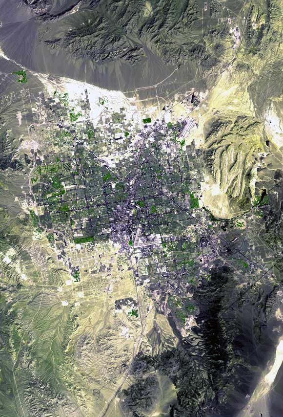
to the city. Looking from space it is very easy to see that the Vegas Valley is
an alluvial fan with the famous strip being at the center. The ground is not
porous and thus the water does not percolate into the ground. Streets become gushing
rivers within minutes. This causes mass wasting, debris flows, and mudslides.

References
Picture number three: courtesy of William Canipe
 |
| Las Vegas Valley from space, notice the alluvial fans to the north, the dry drainage basins, and all the mountain streams converge at the center. (courtesy of Wikipedia and International Space Station) |
One very interesting thing about Southern Nevada is that one used
to be able to watch Nuclear Bomb blasts from downtown bars; this testing has
caused a negative impact on the hydrological system.“From January 1951 through September 1992, 828 underground nuclear
tests were Conducted at the Nevada National Security Site (NNSS; formerly the
Nevada Test Site). Depths of these tests ranged from 30 to 1,500 meters below
the ground surface with approximately
one-third of these tests being at or below the groundwater table." (FS.FED). The future of this landscape will be determined by the exploitation or conservation of the hydrology.
References
Picture Number one: courtesy of William Canipe
Picture number two: http://upload.wikimedia.org/wikipedia/commons/6/64/Las_Vegas_Satellite_Map.jpg
Picture number three: courtesy of William Canipe